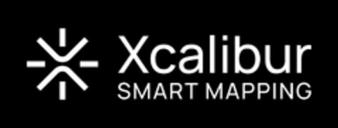
Xcalibur SMART MAPPING Logo (EUIPO, 19.12.2023)
Schützen Sie diese Marke vor Nachahmern!
Mit unserer Markenüberwachung werden Sie automatisch per E-Mail über Nachahmer und Trittbrettfahrer benachrichtigt.
Die Unionsmarke Xcalibur SMART MAPPING wurde als Bildmarke am 19.12.2023 beim Amt der Europäischen Union für Geistiges Eigentum angemeldet.
Sie wurde am 25.04.2024 im Markenregister eingetragen.
Der aktuelle Status der Marke ist "Marke eingetragen (aktive Marke)".
Logodesign (Wiener Klassifikation)
#Andere Darstellungen der Sonne, Sonnen stilisiert
| Markenform | Bildmarke |
| Aktenzeichen | 018966097 |
| Anmeldedatum | 19. Dezember 2023 |
| Veröffentlichungsdatum | 17. Januar 2024 |
| Eintragungsdatum | 25. April 2024 |
| Ablaufdatum | 19. Dezember 2033 |
Markeninhaber
Markenvertreter
Lambroekstraat 5A
1831 Diegem
BE
Waren und Dienstleistungen
42
Geophysische Kartierung von regionalen Gebieten; Vermessung im Zusammenhang mit Mineralien; Vermessung im Zusammenhang mit geothermalen Energiequellen; Erkundung natürlicher Energiequellen; Erkundung von Grundwasser; Vermessung im Zusammenhang mit natürlichem Wasserstoff; Geophysische Erkundung und Vermessung im Zusammenhang mit natürlichem Wasserstoff; Erfassung und Verarbeitung weltraumgestützter Vermessungsdaten; Bereitstellung von geografischen Informationen; Bereitstellung von wissenschaftlichen Informationen und Beratung in Bezug auf Netto-Null-Emission; Bereitstellung von meteorologischen Informationen; Meteorologische Forschung; Meteorologische Vorhersagen; Erstellung ökologischer Erhebungen; Wissenschaftliche Forschung auf dem Gebiet der Ökologie; Umweltkartierung; Durchführung technischer Projekte in den folgenden Bereichen: Klimakompensation; Beratungsleistungen bezüglich der Kompensation von CO2-Emissionen; Bereitstellung von wissenschaftlicher Information und Beratung zum CO2-Ausgleich; Beratung in Bezug auf die folgenden Bereiche: Bekämpfung der Umweltverschmutzung (Prüfarbeiten und Forschung); Messung von Emissionen in Verbindung mit Verschmutzungen; Verschmutzungsmessung; Erstellung von landwirtschaftlichen Gutachten; Landwirtschaftliche Forschungsdienstleistungen; Wasseranalyse; Landvermessung und Landkartierung; Überwachung von Geländen; Beratung auf dem Gebiet des Umweltschutzes; Umweltberatungsdienstleistungen; Bewertung von Umweltgefährdungen; Umweltüberwachung; Erstellung von Umweltgutachten; Umwelt-Nachhaltigkeitsbewertungen in Bezug auf Gebäude und Entwicklungen; Beratung in Bezug auf ökologische Nachhaltigkeit; Durchführung von Umweltprüfungen; Bereitstellung von Informationen in Bezug auf Nachhaltigkeit im Bereich Umwelt; Beratung und Forschungsarbeiten im Bereich der Erhaltung der Umwelt; Wissenschaftliche Analyse, Prüfung und Überwachung zur Erhaltung der Umwelt; Wissenschaftliche und technologische Beratung und Technische und wissenschaftliche Forschungsdienste in Bezug auf die folgenden Bereiche: Umweltverschmutzung und Dienstleistungen im Bereich des Umweltschutzes; Wissenschaftliche Forschung im Bereich des Umweltschutzes; Umweltplanung und -management in Bezug auf die folgenden Bereiche: Bergbau; Luftgestützte elektromagnetische Vermessung; Bereitstellung luftgestützter elektromagnetischer Vermessungsdaten und Analyse luftgestützter elektromagnetischer Vermessungsdaten; Durchführung von geophysikalischen Vermessungen; Bereitstellung luftgestützter radiometrischer Vermessung; Bereitstellung luftgestützter radiometrischer Vermessungsdaten und Analyse luftgestützter radiometrischer Vermessungsdaten; Bereitstellung luftgestützter Schwerkraft-Gradiometer-Vermessungen; Bereitstellung luftgestützter Schwerkraft-Gradiometer-Vermessungsdaten und Analyse luftgestützter Schwerkraft-Gradiometer-Vermessungsdaten; Luft- und seegestützte geophysikalische Schwerkraftvermessung; Luftgestützte maßstäbliche Gravimetrie für die regionale Schwerkraftfeldkartierung und Geoidbestimmung; Entwicklung von Systemen für die Datenverarbeitung; Beratung auf dem Gebiet der künstlichen Intelligenz; Entwurf und Entwicklung von Computersoftware und Computerhardware mit künstlicher Intelligenz; Entwurf und Entwicklung der folgenden Waren: Computerhardware und -software für maschinelles Lernen; Erfassung und Analyse von luft- und satellitengestützten Vermessungsdaten unter Verwendung von künstlicher Intelligenz oder maschinellem Lernen; Luftkartierung; Luftgestützte Lidar-Vermessung und -Kartierung; Luftgestützte multispektrale Bildgebung und Vermessung; Luftgestützte Wärmebildgebung und -vermessung; Analyse und Bewertung von luftgestützten Vermessungsdaten; Luftgestützte hyperspektrale Bildgebung und Vermessung; Orthofotografie; Orthofotografische Kartierung; Satellitenbilder; Satellitengestützte Vermessung; Satellitengestützte Kartierung; Vermessung und Kartierung von Land oder Meer mithilfe von Satelliten, Starrflügelflugzeugen, Hubschraubern oder unbemannten Flugkörpern; Luft- oder satellitengestützte Vermessung; Luft- oder satellitengestützte Bildgebung
ID: 11018966097
 EUIPO
EUIPO